Backcountry Skiing Mt. Blackmore
A classic Bozeman peak, topping out at over 10,000ft.
Overview
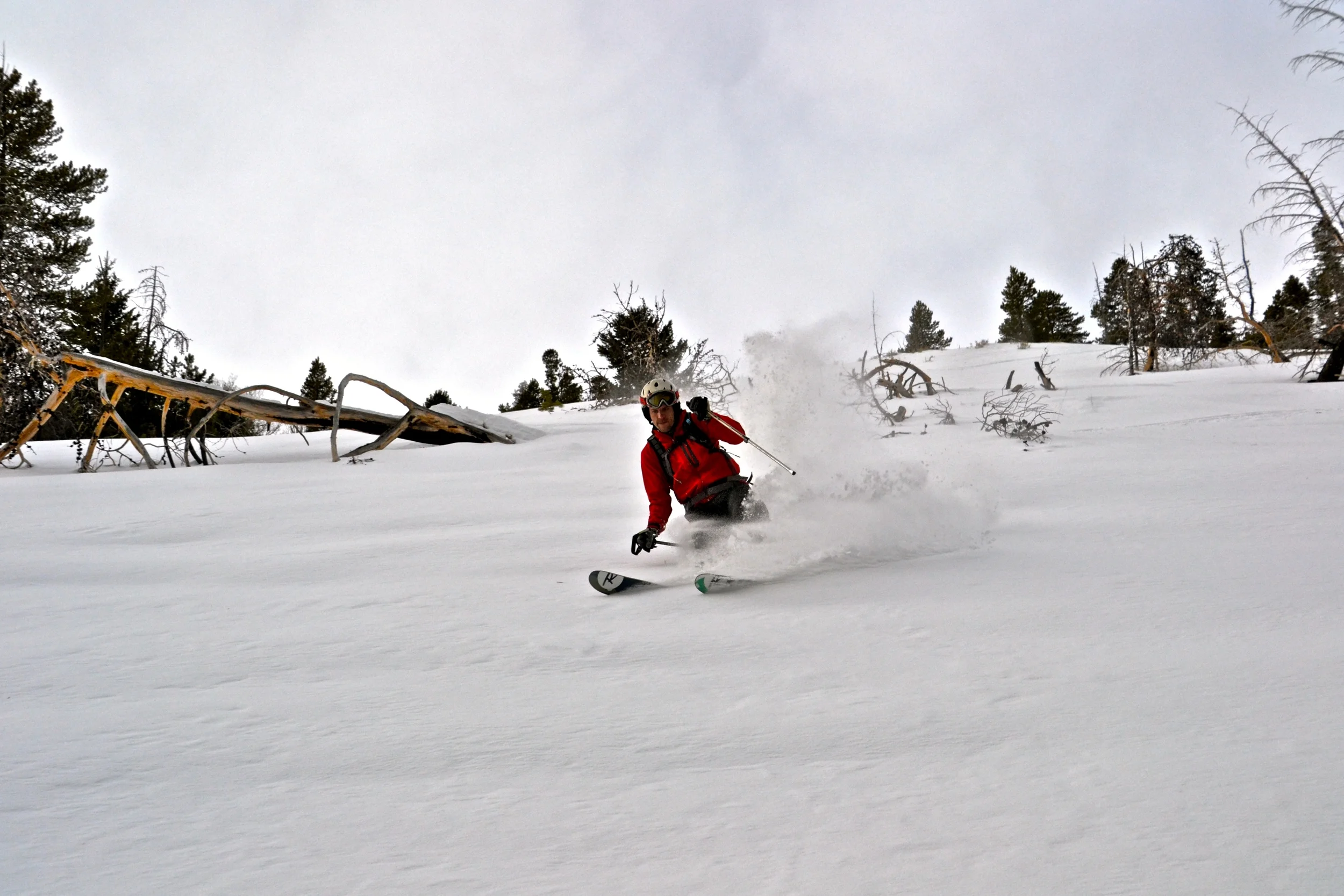
Mt. Blackmore is another classic Bozeman backcountry location. While its epic north face is visible from town and might be the inspiration to get up there in the first place, most folks choose to ski the eastern side of the peak where there is a variety of terrain that ranges from glade skiing right up to wide open above tree-line skiing with nice chute options. You may want to take a whole day to ski Mt. Blackmore so that you have time not only for the relatively long approach, but for both careful snowpack evaluation as well as a few laps in the choice terrain. On the way back down you'll be treated (or cursed, depending on your outlook on life) to a surprisingly fast bobsled course down through the trees. The nearest SNOTEL sensor is at Shower Falls and generally provides a good estimate of the snow at Blackmore.
Avalanche Information
Reaching the very peak of Blackmore is a true winter mountaineering adventure where you’ll likely want an ice ax and crampons on the last couple of hundred feet. Skipping the very top of the peak and instead ascending to “near” the summit, it’s largely possible to avoid the most serious avalanche terrain and use only a standard backcountry approach on skins. There are many descent options on Blackmore, with the safest low-angle descent occurring on the skinner’s right (east) of the peak.
Getting There
Take 19th Avenue south out of Bozeman and follow it as it bends around to the right and continues heading west. Look for the sign to Hyalite Canyon and take a left. Continue heading up Hyalite Canyon until you are just before the reservoir, then park at the large parking lot on the right. The road is plowed during the winter and so just about any car can make the drive in.
Descent Close-Up
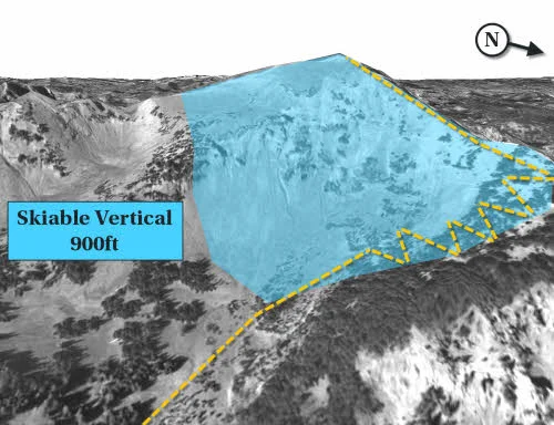
There are many descent options available on Mt. Blackmore, and your chosen route will depend on what kind of adventure you are after. The path illustrated above goes to the very top of the mountain and would require mountaineering expertise to reach the summit, however you can also simply descend before reaching the peak for a great but slightly shorter run.
Map of the Area
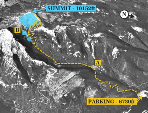
The skin track starts by heading south out of the parking lot and then follows the summer hiking trail to Mt. Blackmore. After leaving the parking lot, you will gain elevation by heading up a series of flat switchbacks and then descend down to Blackmore Lake (A). Given that almost all of the approach follows a Forest Service hiking trail, it is usually free of trees and easy to find your way.
As you get closer to tree-line you’ll notice a few sets of short chutes (B) to left of the skin track. If you maintain the right speed and elevation on the way down, you’ll also be able to ski these as you head back to the parking lot. Continue higher past the tree-line and Mt. Blackmore will come into your view to the right.
This route and 28 others are available in the book, along with GPS waypoint coordinates, full color photographs, and detailed statistics on each adventure.