Backcountry Skiing Beehive Basin
Spectacular scenery, deep snow and easy access.
Overview
Beehive is perhaps THE classic backcountry location in the area and for good reason. Spectacular scenery, deep snow, a wide choice of terrain and a plowed paved trailhead that starts you off at almost 8,000 feet make for some tremendous skiing and a reasonably easy approach. Technically the route described here is known by true locals as "Bear-Hive" because you ascend out of Beehive Basin and then ski down into Bear Basin.
Avalanche Information
Skiing down from the Beehive-Bear ridge back into Beehive warrants extra caution as this micro terrain has a historically shallow and weak snowpack. This aspect has claimed the lives of at least two riders and resulted in a handful of other avalanche accidents. Don't forget your good decision making just because you've had some good laps on the safer Bear Basin side! Your safest trip back down is to follow the protected skin track you came up on.
Other Notes
Make sure to stay off the private property that lines both sides of the first mile of the trail. While it may be tempting to trespass, the police do occasionally setup shop on road crossings where they've noticed a skin trail set up over private land, and they will issue citations to skiers and riders.
Getting There
Take US 191 south from Bozeman and turn right to go to Big Sky. Go past the last left turn to Big Sky Resort and turn right at the brown Forest Service access sign for the Beehive Basin trailhead. Follow this road until you decline a steep hill and reach the parking lot. While this road is both paved and plowed all year, the last section of the road has a tendency to prevent cars without dedicated snow tires or chains from leaving at the end of the day! This trailhead can get busy during the winter, so plan on arriving before 9 am to grab one of the few parking spots left.
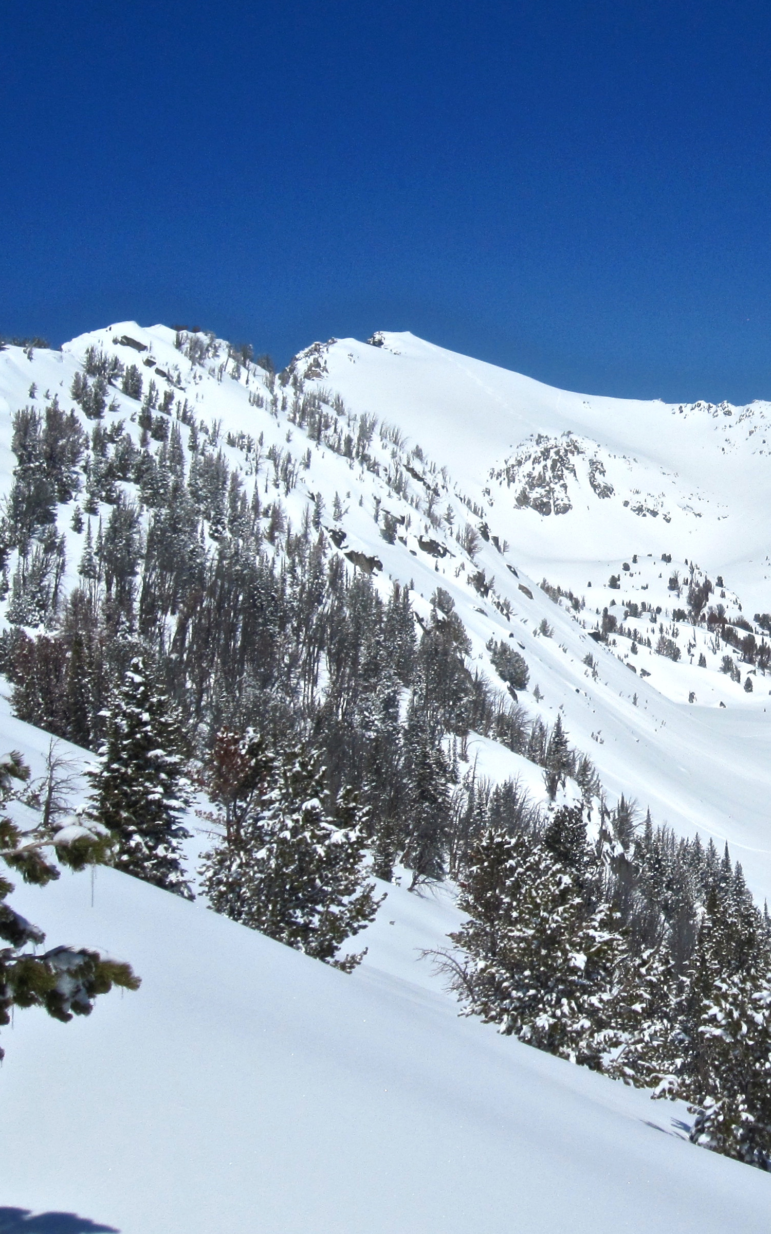
View of Bear Basin with "Buttcrack" chute off in the distance.
Descent Close-Up

Once you gain the main ridge between Beehive and Bear Basins, the descent takes you down 1000 glorious feet of vertical to the bottom of Bear Basin. Make sure your skins are in good working shape as you'll have to skin back up to the ridge to get home. There are also several great descent options along this ridge and generally less traffic the farther you head up the ridge as Bear Basin eventually turns into Middle Basin.
Map of the Area
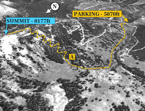
The safest ascent route takes a right (A) after the private property ends and switchbacks its way up a heavily treed small ridge until you reach the ridge between Beehive and Bear Basins.
This route and 28 others are available in the book, along with GPS waypoint coordinates, full color photographs, and detailed statistics on each adventure.